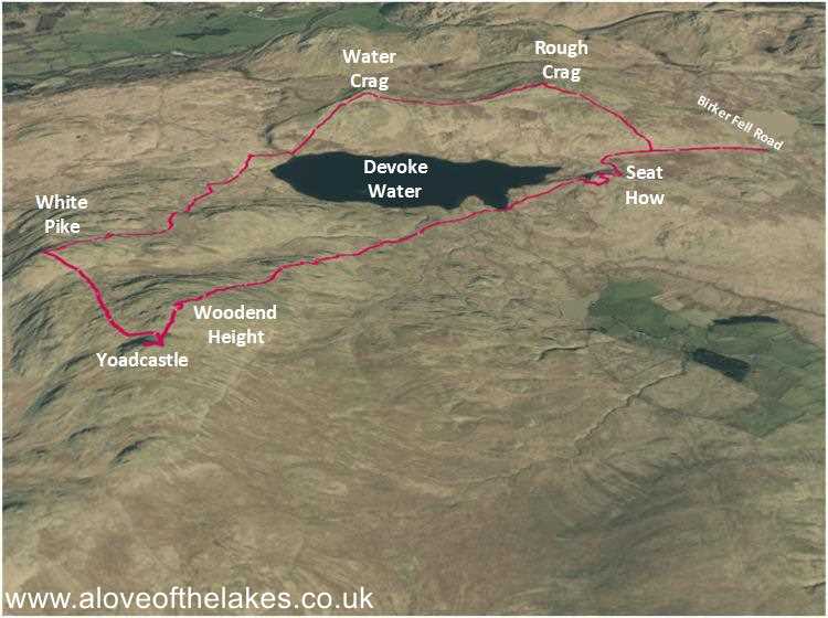
Terrain Overview
Walk Overview
A circuit of Devoke Water taking in 6 Wainwright Outliers. A beautiful setting
for a walk that MUST be done in fairly dry conditions. The paths to the first
2 Fells are very good and gentle. The path from Water Crag to White Pike
is a pathless, boggy, weary trudge on Sphagnum Moss with route finding a challenge.
After that a decent track from White Pike to Yoadcastle and thereonin straightforward
walking back to the start
The Birker Fell Road leading out of Ulpha is the start point for this walk. A clear
sign post along the route is right at the very start of the trail
To the right of the sign post there is a free to use parking area capable of taking
several cars. Today parking was not an issue
The views from the car park across to the Scafell range of mountains
Setting out on the path towards the first fell of the day … Rough Crag
Shortly after passing through a wooden gate, keep a look out on the right
for a grassy trod some 20 or 30 metres after the gate, which leads unerringly
to the summit of Rough Crag. Very easy walking
Passing what will be the final fell of the day, Seat How from the path to Rough Crag
The very gently rising grassy trod that leads to the summit of Rough Crag
Sue and Spud on the summit of Rough Crag. The wind was gale force. Click here
for a 360 degree view
The very straightforward route to the second summit of the day … Water Crag
A good view of Devoke Water from the easy path to Water Crag
The very easy track towards the summit of Water Crag
Yet again when we reach the summit of Water Crag the
wind speed picks up to Gale force
Looking across over Devoke Water to the third summit of the day, White Pike.
Don't be fooled by the benign appearance of the route. What follows is a
tough walk over pathless and boggy ground. The Pike itself is out of view throughout
until you cross the ridgeline seen at the top of the photo. My best advice is to keep right
Passing the northern shore of Devoke Water
This area of ground is extremely boggy and there are a number of
tributary streams that emit from Devoke Water that need to be crossed
Just aim for the ridgeline right of centre in the shot
Looking back to Water Crag
Around here the Sphagnum Moss becomes very thick and spongy making
the walk a lot harder than it should be. White Pike is still out of sight at this point
just keep aiming for the outcrops that can be seen on the ridgeline
We pass Woodend Height on the left as we journey along to the ridgeline. This
will be the 5th fell of the day when we reach there
Looking across to the Scafell range as we journey towards the ridgeline
Keep heading for the dip in the ridgeline
Eventually the summit cairn on White Pike comes into view
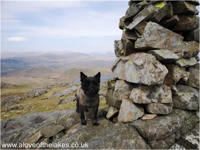
Spud on the summit of White Pike. Click here for a 360 degree view from the summit
Looking towards the next fell of the day … Yoadcastle. Very straightforward
walking from here on. Click here for a 360 degree view from the summit
From the summit of Yoadcastle, Woodend Height is just a very short
walk along the path shown here in the depression
Approaching the summit cairn on Woodend Height
Sue on the summit of Woodend Height. Click here for a 360 degree view
All that remains on the circuit now is the final fell of the day seen here in the distance
just off the southern shore of Devoke Water. Whilst the path is sketchy there
is no difficulties in navigation
Approaching the Boat House that is just before the start of the climb to Seat How
Follow the obvious stone track that goes behind the Boat House
Approaching the base of Seat How
On approaching the base of the fell it looks fairly impossible to get up on
the summit. However, aim right and follow a wide grassy path that winds round
the southern flank of the fell to reach the summit with ease
Sue and Spud on the summit of the final fell of the round Seat How. Click here for a
360 degree view from the summit


